

First Circular
The International Symposium on GPS
- Application to Earth Sciences and
Interaction with Other Space Geodetic Techniques -
[GPS99 in Tsukuba]
Period : October 18th (Mon.) - 22nd (Fri.), 1999
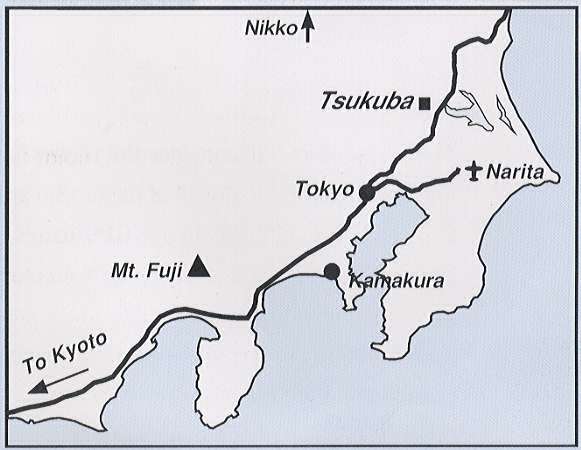
Place : Tsukuba International Convention Center,
Tsukuba, Ibaraki, Japan
A part of the symposium is dedicated to
The Third International Meeting of
the Asia-Pacific Space Geodynamics Program
Scope:
The symposium will consider the recent increase in GPS applications to
earth sciences. The Local Organizing Committee cordially invite all of those
who are interested in the following subjects;
 Crustal deformations by dense GPS arrays in Southern California, Japan etc.
Ground-based and space-based GPS meteorology,
Investigation of ionosphere
Application to earth rotation studies; geocenter and reference frame etc.
Combination of SLR and GPS
Integrated space geodetic network using VLBI, GPS, GLONASS, etc.
GPS and other techniques such as SAR, gravity measurements, etc.
Crustal dynamics in the Eastern Asia and the Western Pacific, and their
numerical modelling,
Physical process at plate boudary; slow earthquakes, superplume, backarc
spreading, etc.
Kinematic GPS for monitoring seismic waves, tsunamis, ice flow, sea bottom
displacements, etc.
Local array for volcano and earthquake monitoring and hazard reduction
Application of GPS for monitoring sealevel change
Collaborations between international projects; WING, APSG, GEODESSIA, etc.
Regional aspects and roles of the International GPS Service (IGS)
New and future space technologies and combination with conventional space
techniques
Tutorial sessions for those who are beginning GPS researches, etc.
Sponsors
Venue:
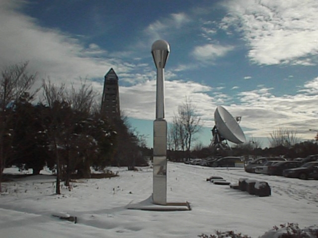
The symposium will be held in Tsukuba where the Geographical Survey
Institute operates the nationwide dense GPS array in Japan. The area is
conveniently located for visiting glorious old shrines in Nikko as well as
other scientific institutes. A couple of scientific and sightseeing tours
will be prepared by the Local Organizing Committee.
Symposium conveners:
 Michael Bevis, HIGP, University of Hawaii, USA
Yehuda Bock, SIO, University of California San Diego, USA
Oscar L. Colombo, University of Maryland/NASA GSFC, USA
Jeffrey T. Freumueller, Geophysical Institute, University of Alaska, USA
Yuki Hatanaka, Geographical Survey Institute, Japan
Kosuke Heki, National Astronomical Observatory, Japan
Bill Kuo, NCAR, USA
Seiichi Shimada, NIED, Japan
Randolph Ware, UCAR/UNAVCO, USA
Ye Shu-Hua, Shanghai Observatory, China
Shui-Beih Yu, Academia Sinica, Taiwan
Torao Tanaka (Chairman: Local Organizing Committee)
Disaster Prevention Research Institute, Kyoto University
Gokasho, Uji, Kyoto 611-0011, Japan
Phone: +81-774-38-4225 Fax: +81-774-38-4239
e-mail:tora@rcep.dpri.kyoto-u.ac.jp
Those who are interested in obtaining further information about this
symposium are encouraged to send your name, address, phone/fax and e-mail
address to the following address;
 CSTG (Commission VIII in Section II of IAG and Commission B.2
of COSPAR)
CSTG (Commission VIII in Section II of IAG and Commission B.2
of COSPAR)